Shanghai city map
You can find on this page the Shanghai map to print and to download in PDF. The Shanghai offline map presents the city center and the location in world map of Shanghai in China.
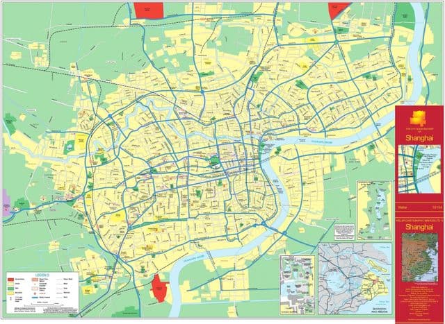
Shanghai map
The Shanghai map shows the detailed map and a large map of Shanghai. This map of Shanghai will allow you to orient yourself in Shanghai in China. The Shanghai map is downloadable in PDF, printable and free.
Shanghai sits on the Yangtze River Delta on China eastern coast as its mentioned in Shanghai map, and is roughly equidistant from Beijing and Hong Kong. The municipality of Shanghai as a whole consists of a peninsula between the Yangtze and Hangzhou Bay, mainland China second-largest island Chongming, and a number of smaller islands. Shanghai is bordered on the north and west by Jiangsu Province, on the south by Zhejiang Province, and on the east by the East China Sea.
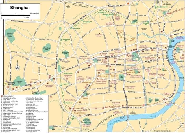
Shanghai downtown map
The map of downtown Shanghai shows the historical center of Shanghai. This downtown map of Shanghai will allow you to easily plan your visit in the center of Shanghai in China. The Shanghai downtown map is downloadable in PDF, printable and free.
The historic center of the city of Shanghai, the Puxi area, is located on the western side of the Huangpu, while the newly developed Pudong, containing the central financial district Lujiazui, was developed on the eastern bank. The real city center or downtown of Shanghai is between Bund to the east, Nanjing Rd to the north, Old City Temple and Huaihai Road to the south as its mentioned in Shanghai downtown map. Prominent central business areas include Lujiazui on the east bank of the Huangpu River, and The Bund and Hongqiao areas in the west bank of the Huangpu River.
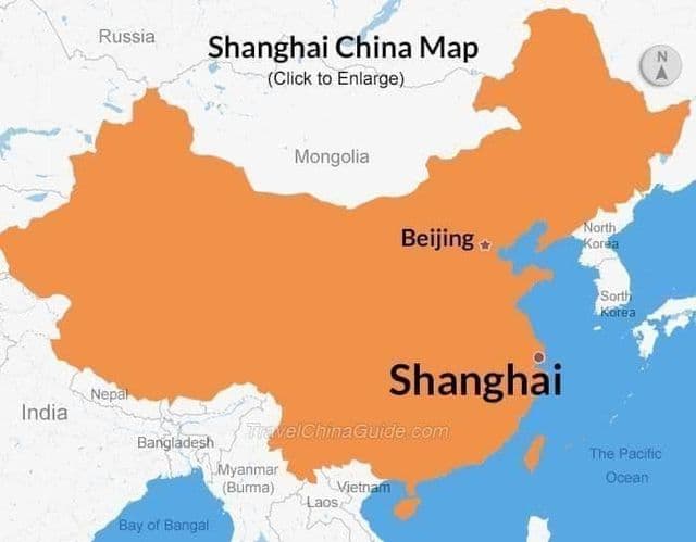
Shanghai China map
Shanghai on China map shows the location of the city of Shanghai on the China map. This map of Shanghai in China will allow you to easily plan your travel in Shanghai in China. Shanghai on map of China is downloadable in PDF, printable and free.
Shanghai is the largest city by population of the People Republic of China (PRC) as its shown in Shanghai China map. It is one of the four province-level municipalities of the PRC, with a total population of over 23 million as of 2010. Based on population of total administrative area, Shanghai is the second largest of the four direct-controlled municipalities of China, behind Chongqing, but is generally considered the largest city in China because Chongqing’s urban population is much smaller.
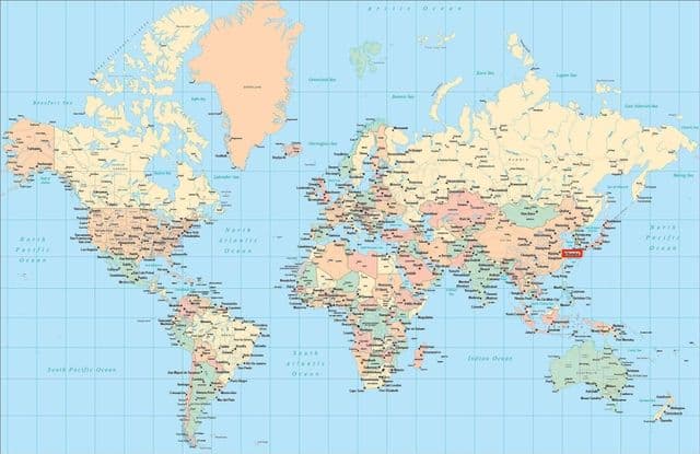
Shanghai on world map
Shanghai on world map shows the location of the city of Shanghai in the world. Shanghai on world map will allow you to easily know where is Shanghai in the world. The Shanghai in world map is downloadable in PDF, printable and free.
The largest city proper by population in the world. Shanghai had become the world fifth largest city and home to 70,000 foreigners as its mentioned in Shanghai on world map. In the 1930s, some 30,000 Jewish refugees from Europe arrived in the city. While Shanghai natural growth rate has been negative since 1993 due to its extremely low fertility rate — just 0.6 in 2010, probably the lowest level anywhere in the world.